Key Facts
View key facts for "Unearth Technologies".
1- How is Unearth different from other field operations software? Unearth is a Mobile GIS designed to manage physical assets, streamline operational workflows, and enhance field service. Unlike other field operations platforms, Unearth is centered around a map. Not only can field workers geotag data to existing assets, but all data is organized by location - viewable in a table, list, or map. 2- Is Unearth mobile friendly? Yes, Unearth was built to work on any mobile phone or tablet. 3- Does it work on iOS and Android? Yes, both. Unearth’s native Android and iOS applications help pinpoint GPS location in the field and are offline-ready for remote field work. That said, Unearth’s web application is available on any device if connectivity isn’t an issue. 4- Do I need specific hardware to access Unearth? No, it works on any standard cell phone, laptop, or desktop computer. But if you’d like even more precise GPS, Unearth includes an integration with Trimble R2 data collectors. 5- Do I need a Wi-Fi connection? Yes and no. While Unearth’s web application requires an internet connection, the Android and iOS applications offer an offline mode that enables data capture without WiFi. However, you will need an internet connection to upload that data to the cloud. 6- How do you store data? All Unearth data is stored in the cloud on Amazon Web Services (AWS) servers. 7- How secure is my data? Very. AWS provides a robust security infrastructure designed to increase privacy and control network access. Plus, Unearth is Soc 2 Type 2 compliant and provides multiple layers of security, including 256-bit TLS enforcement, end-to-end web-socket communication encryption, and authentication. 8- Is it possible to bulk video, CCTV, and photos? Yes, all of the above. Unearth was built to manage large uploads of both photos and videos. In OnePlace, you can bulk upload critical infrastructure data and - once in the field - geotag multimedia to existing assets. What’s more, OnePlace ingests satellite, UAV, LiDAR imagery, precision GPS readings, and GIS data. 9- Storing videos takes a ton of storage. How do you handle that? Unearth backs OnePlace’s intuitive data collection tools with unlimited cloud storage - so you can upload all the multimedia you need to communicate with precision and clarity in the field. With cloud servers, Unearth exponentially increases storage capacity. 10- Do you provide satellite imagery for the map? Yes, Unearth sources satellite basemaps from Mapbox. 11- Can I share data from Unearth with stakeholders outside my department or organization? Yes, Unearth offers view-only licenses, so stakeholders can visualize a project’s data directly in OnePlace without being able to modify any information. Moreover, you can produce robust documentation in minutes and export data into the file type of your choice—CSV, XLS, PDF, Shapefile, GeoJSON, KML. 12- I have a question I don't see answered here. Explore full product documentation in the help center. Additionally, Unearth’s Customer Support team is always happy to answer questions - just reach out to support@unearthlabs.com.
More than 30 days
Linux Cloud, SaaS, Web IOS Mac Windows
Case Studies (3)
View featured case studies using "Unearth Technologies".

AEC Companies / Customers (3)
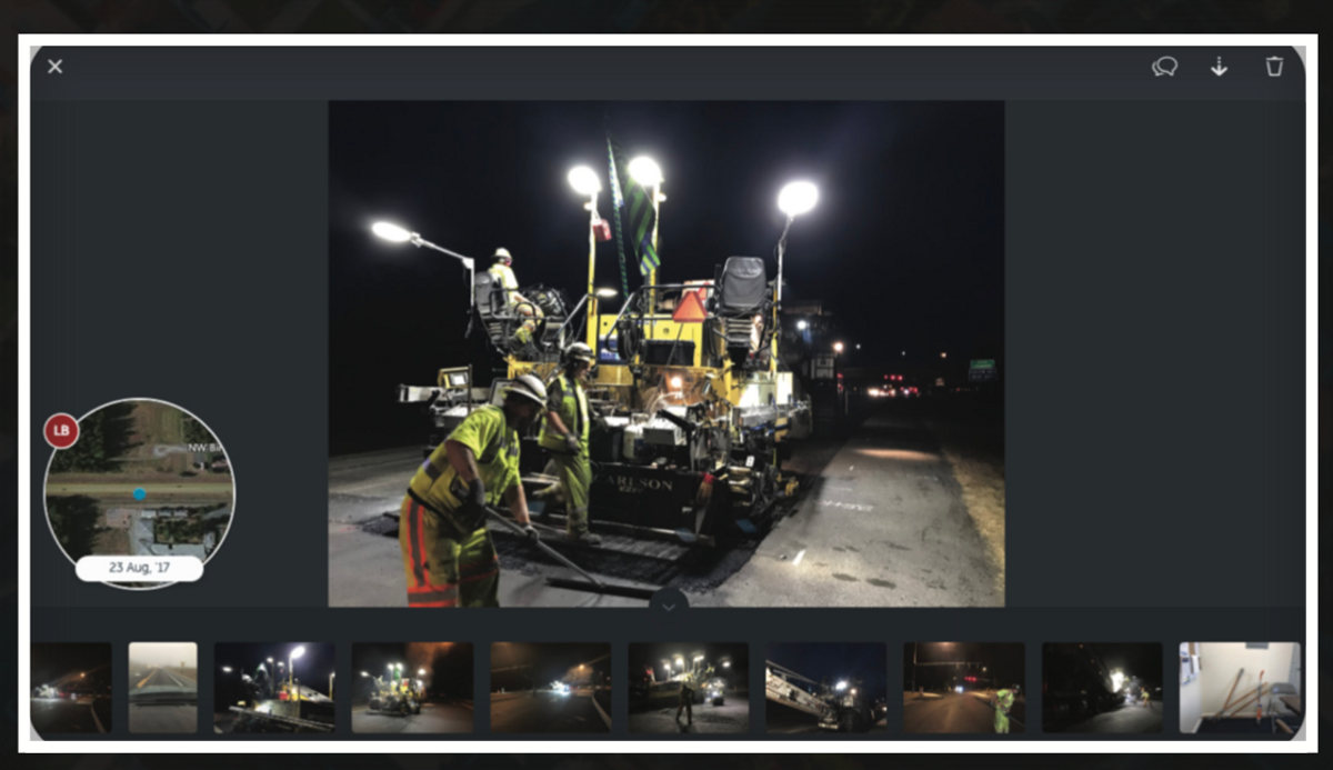
Discover companies and professionals that are utilizing "Unearth Technologies".

Similar Tools
Discover similar tools to "Unearth Technologies".
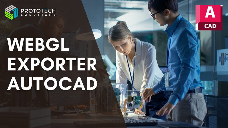
WebGL Exporter for AutoCAD
ProtoTech's WebGL Exporter For Autodesk® AutoCAD exports your model to an HTML file. You can manipulate the view and share your model in the browser without having to install any extra applications or plugins. Fore more details visit: https://prototechsolutions.com/3d-products/autocad/webgl-exporter/ Some Features: 1. Control to adjust mesh quality 2. Supports face-level colors 3. Integrate your exported 3D model on the web page 4. Option is provided to control the file size and quality by specifying precision value
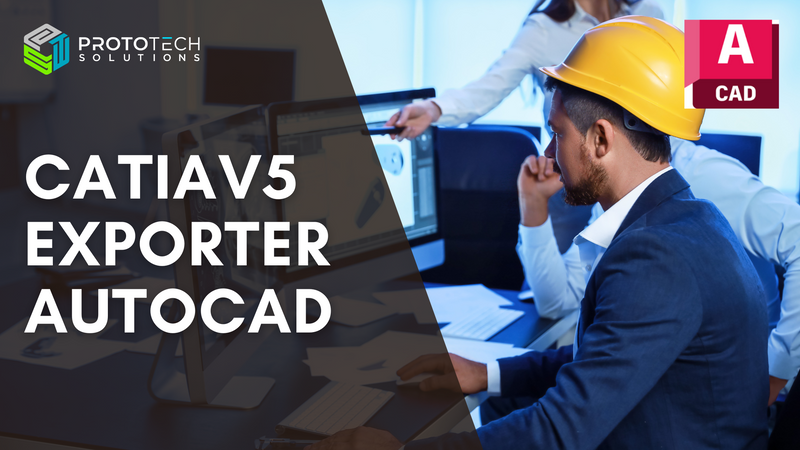
CatiaV5 Exporter for AutoCAD
ProtoTech's CatiaV5 Exporter for Autodesk® AutoCAD® streamlines workflows across industries by converting AutoCAD drawings to CatiaV5 format. This enhances design integration, collaboration, and precision for automotive, aerospace, manufacturing, industrial design, construction, and educational sectors.
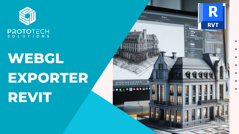
WebGL Exporter For Revit
ProtoTech's WebGL for Revit integrates WebGL's real-time 3D rendering capabilities into Autodesk Revit, allowing users to export Revit models to web-compatible formats like glTF. This enables interactive 3D visualization directly in web browsers on any device, facilitating easy sharing, enhanced collaboration, and real-time model interaction without the need for specialized software. Key benefits include improved accessibility, cost-effective sharing, and scalability, making it ideal for client presentations, design reviews, construction planning, and facility management.
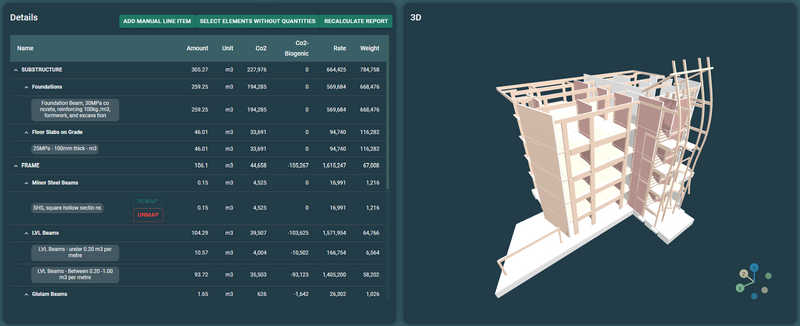
Vizcab
360° Building Carbon Platform, focusing on the embodied carbon impact of materials and Life Cycle Assessment (LCA)
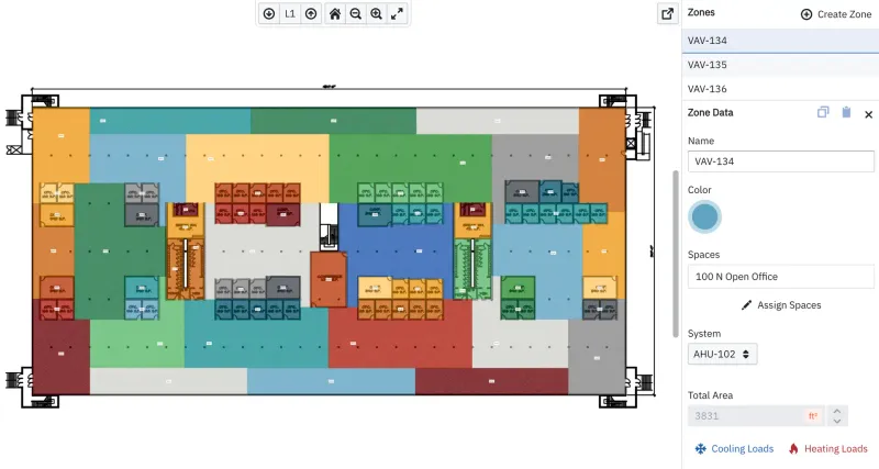
HVAKR
A cloud-based HVAC design platform, HVAKR radically reduces the cost and duration of developing mechanical designs by consolidating the process into one, user-friendly environment.
V-Quest
We help our user balance decarbonisation with project budget and cost opportunity. Ensuring best possible building performance.